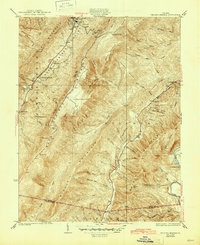
1933 Map of Healing Springs
USGS Topo · Published 1945About this map
Hot Springs and the surrounding Warm Springs Valley define this early 1930s survey of Bath County, Virginia. The landscape is a corridor of thermal springs and recreation, featuring the storied Healing Springs and the Cascades Golf Club. Above the valley floor, the terrain rises sharply into Warm Springs Mountain and Bald Knob Mountain, where high-elevation landmarks like Trappers Lodge and the George Washington Trail provide evidence of early forestry and trail systems.
Find a feature on this map
70 named features on this map. Tap any name to fly to it.
Don’t see what you’re looking for? This feature index may not catch every label — zoom into the map to look around manually.
Map Details
Editions of this 1933 Healing Springs Map
3 editions found

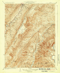
Other maps of this area

1894 · Natural Bridge
USGS Topo · 1:125,000

1901 · Monterey
USGS Topo · 1:125,000

1923 · Warm Springs
USGS Topo · 1:48,000

1926 · Warm Springs
USGS Topo · 1:62,500

1929 · Falling Spring
USGS Topo · 1:24,000

1930 · Warm Springs Run
USGS Topo · 1:24,000

1930 · Mountain Grove
USGS Topo · 1:24,000

1931 · Healing Springs
USGS Topo · 1:24,000

1932 · Falling Spring
USGS Topo · 1:31,680

1933 · Mountain Grove
USGS Topo · 1:31,680