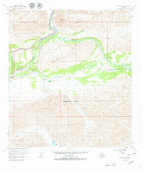
1949 Map of Healy B-4
USGS Topo · Published 1980About this map
Cantwell serves as the focal point for this landscape where the Denali Highway meets the corridor of the Railroad. The map illustrates the confluence of the Nenana River and Jack River, highlighting the logistical infrastructure of mid-century Alaska, including the Golden North Airport and a specialized Tractor Trail winding through the western hills.
Find a feature on this map
29 named features on this map. Tap any name to fly to it.
Don’t see what you’re looking for? This feature index may not catch every label — zoom into the map to look around manually.
Map Details
Editions of this 1949 Healy B-4 Map
4 editions found
Other maps of this area

1949 · Healy B-4
USGS Topo · 1:63,360

1949 · Healy C-3
USGS Topo · 1:63,360

1950 · Healy C-4
USGS Topo · 1:63,360

1950 · Healy A-3
USGS Topo · 1:63,360

1950 · Healy B-3
USGS Topo · 1:63,360

1950 · Healy A-4
USGS Topo · 1:63,360

1950 · Healy A-5
USGS Topo · 1:63,360

1950 · Healy B-5
USGS Topo · 1:63,360

1951 · Healy
USGS Topo · 1:250,000

1951 · Healy B-5
USGS Topo · 1:63,360