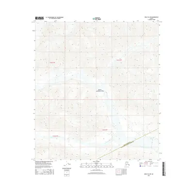
2016 Map of Healy B-6 SW
USGS Topo · Published 2016About this map
Denali National Park encompasses the central portion of this high-latitude terrain, where the headwaters of the West Fork Chulitna River carve through the landscape. The river system, including Ruby Cr, dictates the drainage patterns across the survey, flowing south and east through the expansive glacial valleys. This 2016 survey documents the political transition between the Denali Borough and Matanuska-Susitna Borough, illustrating the vast, unpopulated character of the Alaska Range. While devoid of named settlements or infrastructure, the map provides precise topographic data for the township sections of t18s r12w, t18s r13w, t19s r12w, and t19s r13w. It remains an essential record for understanding the natural hydrology and official borough boundaries in a region defined by its wilderness and massive elevation shifts.
Find a feature on this map
8 named features on this map. Tap any name to fly to it.
Don’t see what you’re looking for? This feature index may not catch every label — zoom into the map to look around manually.
Map Details
Editions of this 2016 Healy B-6 SW Map
This is the sole edition of this map. No revisions or reprints were ever made.
Other maps of this area

1949 · Healy A-6
USGS Topo · 1:63,360

1951 · Healy
USGS Topo · 1:250,000

1952 · Mount McKinley
USGS Topo · 1:250,000

1952 · Mount McKinley B-1
USGS Topo · 1:63,360

1953 · Healy A-6
USGS Topo · 1:63,360

1954 · Healy B-6
USGS Topo · 1:63,360

1954 · Mount McKinley B-1
USGS Topo · 1:63,360

1954 · Mount McKinley A-1
USGS Topo · 1:63,360

1956 · Healy
USGS Topo · 1:250,000

1958 · Mount McKinley
USGS Topo · 1:250,000