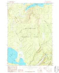
1986 Map of Heart Lake
USGS Topo · Published 1986About this map
Yellowstone National Park reveals its high-altitude backcountry in this mid-1980s topographic survey, defined by the winding spine of the Continental Divide. The landscape is dominated by the massive water bodies of Yellowstone Lake to the north and Heart Lake to the southwest, connected by the drainage systems of Beaver Creek and Surprise Creek. The terrain is marked by significant vertical relief, rising from the lake basins to the summit of Flat Mountain and the prominent Chicken Ridge.
Find a feature on this map
13 named features on this map. Tap any name to fly to it.
Don’t see what you’re looking for? This feature index may not catch every label — zoom into the map to look around manually.
Map Details
Editions of this 1986 Heart Lake Map
This is the sole edition of this map. No revisions or reprints were ever made.
Other maps of this area

1885 · Lake
USGS Topo · 1:125,000

1886 · Shoshone
USGS Topo · 1:125,000

1888 · Shoshone
USGS Topo · 1:125,000

1895 · Shoshone
USGS Topo · 1:125,000

1895 · Lake
USGS Topo · 1:125,000

1896 · Lake
USGS Topo · 1:125,000

1901 · Shoshone
USGS Topo · 1:125,000

1901 · Lake
USGS Topo · 1:125,000

1906 · Lake
USGS Topo · 1:125,000

1908 · Shoshone
USGS Topo · 1:125,000