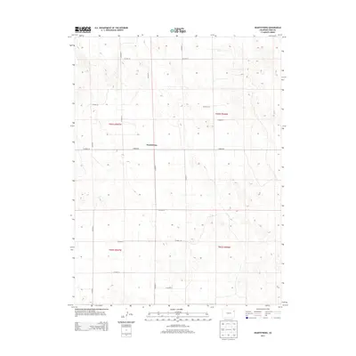
2013 Map of Heartstrong
USGS Topo · Published 2013About this map
Heartstrong sits at the center of this agricultural landscape in northeastern Colorado, where the High Plains are defined by a strict section-line road network. The settlement is positioned at the intersection of Co Road 26 and Co Road N, serving as a focal point for the surrounding dryland farming community. The terrain is characterized by subtle topographic undulations, with a grid of local connectors including Co Road M, Co Road P, and Co Road L providing access to isolated homesteads and field plots. This 2013 survey by the U.S. Geological Survey details the township and range boundaries that have governed land ownership in Yuma County since the initial homesteading era. Researchers can observe the meticulous placement of east-west routes like Co Road 29 and Co Road 20, which reflect the enduring legacy of the Public Land Survey System in organizing the rural Western landscape.
Find a feature on this map
18 named features on this map. Tap any name to fly to it.
Don’t see what you’re looking for? This feature index may not catch every label — zoom into the map to look around manually.
Map Details
Editions of this 2013 Heartstrong Map
This is the sole edition of this map. No revisions or reprints were ever made.
Other maps of this area

1954 · Limon
USGS Topo · 1:250,000

1954 · Sterling
USGS Topo · 1:250,000

1957 · Limon
USGS Topo · 1:250,000

1958 · Limon
USGS Topo · 1:250,000

1958 · Sterling
USGS Topo · 1:250,000

1961 · Eckley
USGS Topo · 1:24,000

1968 · Abarr SE
USGS Topo · 1:24,000

1968 · Vernon SW
USGS Topo · 1:24,000

1969 · Heartstrong
USGS Topo · 1:24,000

1969 · Vernon NW
USGS Topo · 1:24,000