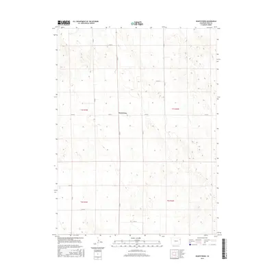
2016 Map of Heartstrong
USGS Topo · Published 2016About this map
Heartstrong sits at a remote crossroads in the high plains of northeastern Colorado, representing a quiet agricultural landscape defined by the Public Land Survey System. This 2016 survey illustrates a geometric grid of county roads, including Co Rd 29 and Co Rd 27.5, which navigate the subtle topography of the Sand Hills region. The map captures the intersection of four townships—t1s r47w, t1s r46w, t2s r47w, and t2s r46w—underscoring the systematic division of land that has governed Yuma County since settlement. The sparse distribution of named features emphasizes the vastness of this ranching and farming territory, where small communities like Heartstrong serve as essential anchor points for local history and genealogical research in a landscape where few other landmarks are named.
Find a feature on this map
7 named features on this map. Tap any name to fly to it.
Don’t see what you’re looking for? This feature index may not catch every label — zoom into the map to look around manually.
Map Details
Editions of this 2016 Heartstrong Map
This is the sole edition of this map. No revisions or reprints were ever made.
Other maps of this area

1954 · Limon
USGS Topo · 1:250,000

1954 · Sterling
USGS Topo · 1:250,000

1957 · Limon
USGS Topo · 1:250,000

1958 · Limon
USGS Topo · 1:250,000

1958 · Sterling
USGS Topo · 1:250,000

1961 · Eckley
USGS Topo · 1:24,000

1968 · Abarr SE
USGS Topo · 1:24,000

1968 · Vernon SW
USGS Topo · 1:24,000

1969 · Heartstrong
USGS Topo · 1:24,000

1969 · Vernon NW
USGS Topo · 1:24,000