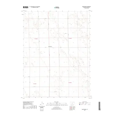
2019 Map of Heartstrong
USGS Topo · Published 2019About this map
Heartstrong sits at the center of this rural Yuma County landscape, defined by a rigid grid of agricultural section lines and county roads. The terrain is characterized by the subtle depressions and rises of the High Plains, where the 2019 survey shows a network of local transport including Co Rd 26 and Co Rd N. This region, organized under the Public Land Survey System within t1s r47w and surrounding townships, reflects the enduring spatial organization of Colorado's eastern plains. The lack of dense urbanization or major water bodies highlights the area's specialized focus on dryland farming or ranching, with the small cluster at Heartstrong serving as the primary local identifier for residents and genealogists tracing family land holdings in this part of the county.
Find a feature on this map
16 named features on this map. Tap any name to fly to it.
Don’t see what you’re looking for? This feature index may not catch every label — zoom into the map to look around manually.
Map Details
Editions of this 2019 Heartstrong Map
This is the sole edition of this map. No revisions or reprints were ever made.
Other maps of this area

1954 · Limon
USGS Topo · 1:250,000

1954 · Sterling
USGS Topo · 1:250,000

1957 · Limon
USGS Topo · 1:250,000

1958 · Limon
USGS Topo · 1:250,000

1958 · Sterling
USGS Topo · 1:250,000

1961 · Eckley
USGS Topo · 1:24,000

1968 · Abarr SE
USGS Topo · 1:24,000

1968 · Vernon SW
USGS Topo · 1:24,000

1969 · Heartstrong
USGS Topo · 1:24,000

1969 · Vernon NW
USGS Topo · 1:24,000