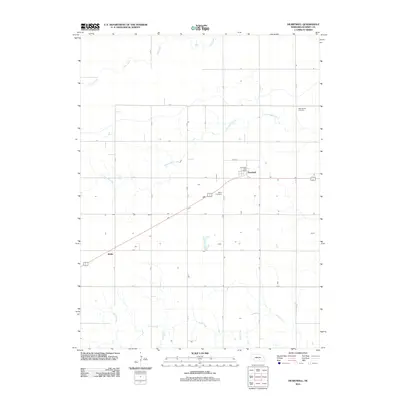
2011 Map of Heartwell
USGS Topo · Published 2011About this map
Heartwell serves as the central hub of this agricultural landscape in Kearney County, where the Heartwell Post Office remains a local anchor. The terrain is organized by a strict section-line road grid, with routes like 39 Rd and N Rd cutting through the open country. This 2011 survey reveals the enduring rural character of the region, anchored by historical burial grounds such as Holy Family Cemetery and Eaton Cemetery. Waterways including Cottonwood Creek, Dry Creek, and Sand Creek meander across the plains, offering a natural contrast to the geometric precision of the farm plots. Smaller localities such as Koller and Brennen appear as quiet points along the rail and road corridors, illustrating the sparse but intentional distribution of early twentieth-century settlements that continue to define the area's geography.
Find a feature on this map
22 named features on this map. Tap any name to fly to it.
Don’t see what you’re looking for? This feature index may not catch every label — zoom into the map to look around manually.
Map Details
Editions of this 2011 Heartwell Map
This is the sole edition of this map. No revisions or reprints were ever made.
Other maps of this area

1894 · Kenesaw
USGS Topo · 1:62,500

1894 · Minden
USGS Topo · 1:62,500

1896 · Wood River
USGS Topo · 1:125,000

1897 · Red Cloud
USGS Topo · 1:125,000

1955 · Grand Island
USGS Topo · 1:250,000

1957 · Grand Island
USGS Topo · 1:250,000

1958 · Grand Island
USGS Topo · 1:250,000

1962 · Denman
USGS Topo · 1:24,000

1962 · Newark
USGS Topo · 1:24,000
1962 · Gibbon South
USGS Topo · 1:24,000