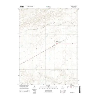
2014 Map of Heartwell
USGS Topo · Published 2014About this map
The village of Heartwell serves as the primary hub of this rural Kearney County landscape, situated along the Us-34 corridor. The layout of the town is defined by its street grid, including Main St and N Railway St, reflecting its historical reliance on transportation. To the southwest, the smaller settlement of Koller appears along the same highway, while the surrounding plains are meticulously organized by a surveyor's grid of rural roads like 40 Rd and S Rd.
Find a feature on this map
25 named features on this map. Tap any name to fly to it.
Don’t see what you’re looking for? This feature index may not catch every label — zoom into the map to look around manually.
Map Details
Editions of this 2014 Heartwell Map
This is the sole edition of this map. No revisions or reprints were ever made.
Other maps of this area

1894 · Kenesaw
USGS Topo · 1:62,500

1894 · Minden
USGS Topo · 1:62,500

1896 · Wood River
USGS Topo · 1:125,000

1897 · Red Cloud
USGS Topo · 1:125,000

1955 · Grand Island
USGS Topo · 1:250,000

1957 · Grand Island
USGS Topo · 1:250,000

1958 · Grand Island
USGS Topo · 1:250,000

1962 · Denman
USGS Topo · 1:24,000

1962 · Newark
USGS Topo · 1:24,000
1962 · Gibbon South
USGS Topo · 1:24,000