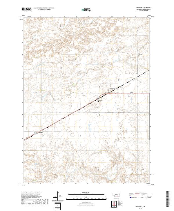
2021 Map of Heartwell
USGS Topo · Published 2021About this map
Heartwell and the smaller settlement of Koller define the inhabited landscape of this Kearney County quadrangle. Situated in the heart of the Nebraska plains, the area is divided by a rigorous grid of section roads, including 38 Rd and R Rd, which support the region's agricultural character. Water management is a critical feature of the terrain, evidenced by the presence of the Adams County Canal and seasonal watercourses like Cottonwood Cr and Sand Cr. Genealogists will find particular value in the documentation of the Holy Family Cem in the northeast and Eaton Cem near the town center. The local infrastructure of Heartwell is detailed down to specific streets such as N Railway St and the local Post Office, reflecting a classic Midwestern rail-town layout that has persisted into the modern era.
Find a feature on this map
33 named features on this map. Tap any name to fly to it.
Don’t see what you’re looking for? This feature index may not catch every label — zoom into the map to look around manually.
Map Details
Editions of this 2021 Heartwell Map
This is the sole edition of this map. No revisions or reprints were ever made.
Other maps of this area

1894 · Kenesaw
USGS Topo · 1:62,500

1894 · Minden
USGS Topo · 1:62,500

1896 · Wood River
USGS Topo · 1:125,000

1897 · Red Cloud
USGS Topo · 1:125,000

1955 · Grand Island
USGS Topo · 1:250,000

1957 · Grand Island
USGS Topo · 1:250,000

1958 · Grand Island
USGS Topo · 1:250,000

1962 · Denman
USGS Topo · 1:24,000

1962 · Newark
USGS Topo · 1:24,000
1962 · Gibbon South
USGS Topo · 1:24,000