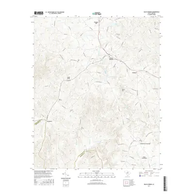
2017 Map of Heath Springs
USGS Topo · Published 2017About this map
Heath Springs and Pleasant Hill serve as the primary hubs in this section of the South Carolina Piedmont, where the landscape is defined by the winding paths of Little Lynches Cr and Hanging Rock Cr. The area reflects a deep-rooted rural settlement pattern, evidenced by numerous family and community burial grounds including Beaver Creek Cem, Hammond Cem, and Rock Hill Cem. Distinctive geological features like Anvil Rock and the landmark Hanging Rock rise above the drainage basins of Camp Cr and Beaver Cr, marking a terrain that transitions toward the Kershaw County line. Small crossroads such as Stoneboro and Robinson Crossroad anchor the local road network, while Sunrise Lake provides a notable water feature in the northern reaches. This 2017 survey by the U.S. Geological Survey documents the enduring rural character of the region through its small-town clusters and naming conventions.
Find a feature on this map
85 named features on this map. Tap any name to fly to it.
Don’t see what you’re looking for? This feature index may not catch every label — zoom into the map to look around manually.
Map Details
Editions of this 2017 Heath Springs Map
This is the sole edition of this map. No revisions or reprints were ever made.
Other maps of this area

1935 · Camden
USGS Topo · 1:48,000

1938 · Camden
USGS Topo · 1:62,500

1941 · Spartanburg
USGS Topo · 1:250,000

1942 · Camden
USGS Topo · 1:125,000

1953 · Spartanburg
USGS Topo · 1:250,000

1960 · Spartanburg
USGS Topo · 1:250,000

1963 · Spartanburg
USGS Topo · 1:250,000

1964 · Spartanburg
USGS Topo · 1:250,000

1968 · Lancaster SE
USGS Topo · 1:24,000

1968 · Heath Springs
USGS Topo · 1:24,000