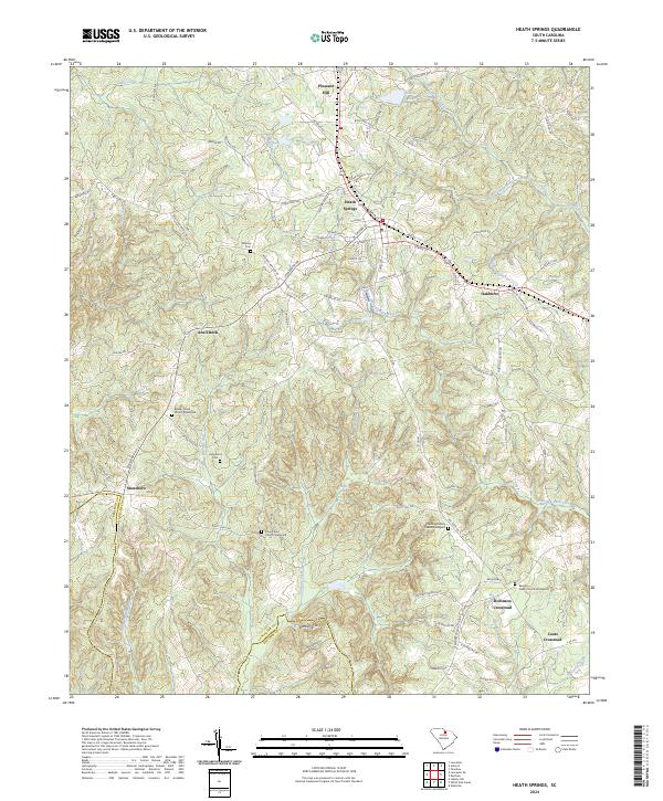
2024 Map of Heath Springs
USGS Topo · Published 2024About this map
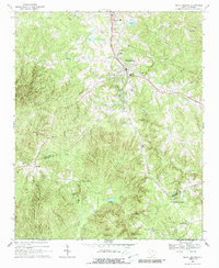
Heath Springs serves as the central hub of this modern survey, where the rolling South Carolina landscape transitions between Lancaster and Kershaw counties. This area is defined by its deep genealogical roots, preserved in numerous burial grounds such as Beaver Creek Church Graveyard and the Mount Zion Church Graveyard. The hydrology is particularly intricate, with Little Lynches Creek and Hanging Rock Creek carving paths through the terrain near smaller settlements like Stoneboro and Oakhurst.
Find a feature on this map
96 named features on this map. Tap any name to fly to it.
Don’t see what you’re looking for? This feature index may not catch every label — zoom into the map to look around manually.
Map Details
Editions of this 2024 Heath Springs Map
This is the sole edition of this map. No revisions or reprints were ever made.