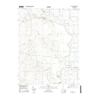
2015 Map of Heathsville
USGS Topo · Published 2015About this map
The Wabash River serves as a winding natural boundary between Illinois and Indiana, shaping the landscape and settlement patterns of this riverine territory. Small communities like Heathsville and Richwoods anchor a network of rural roads, where numerous family and community cemeteries reflect generations of local lineage. Genealogists may find interest in specific sites such as Wesley Chapel Cem, Maddox Cem, and Fuller Cem, which are scattered throughout the agricultural tracts.
Find a feature on this map
105 named features on this map. Tap any name to fly to it.
Don’t see what you’re looking for? This feature index may not catch every label — zoom into the map to look around manually.
Map Details
Editions of this 2015 Heathsville Map
This is the sole edition of this map. No revisions or reprints were ever made.
Other maps of this area

1917 · Birds
USGS Topo · 1:62,500

1942 · Birds
USGS Topo · 1:62,500

1943 · Merom
USGS Topo · 1:24,000

1943 · Carlisle
USGS Topo · 1:24,000

1943 · Oaktown
USGS Topo · 1:24,000

1943 · Sullivan
USGS Topo · 1:24,000

1953 · Indianapolis
USGS Topo · 1:250,000

1956 · Indianapolis
USGS Topo · 1:250,000
1956 · Sullivan
USGS Topo · 1:24,000

1956 · Vincennes
USGS Topo · 1:250,000