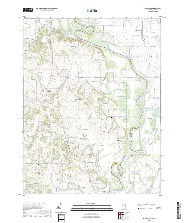
2024 Map of Heathsville
USGS Topo · Published 2024About this map
The Wabash River carves a complex boundary between Illinois and Indiana on this quadrangle, defining a landscape of oxbow lakes, sloughs, and riverine bottomlands. Near the river, features like Long Pond, Buzzard Pond, and Minnow Slough indicate the shifting course of the waterway over time, while Johnsons Cutoff and Horseshoe Cutoff further south reveal more recent hydrological changes. These low-lying areas contrast with the higher ground to the west, where Bristol Hill and Shawn Hill rise above the alluvial plain.
Find a feature on this map
128 named features on this map. Tap any name to fly to it.
Don’t see what you’re looking for? This feature index may not catch every label — zoom into the map to look around manually.
Map Details
Editions of this 2024 Heathsville Map
This is the sole edition of this map. No revisions or reprints were ever made.
Other maps of this area

1917 · Birds
USGS Topo · 1:62,500

1942 · Birds
USGS Topo · 1:62,500

1943 · Merom
USGS Topo · 1:24,000

1943 · Carlisle
USGS Topo · 1:24,000

1943 · Oaktown
USGS Topo · 1:24,000

1943 · Sullivan
USGS Topo · 1:24,000

1953 · Indianapolis
USGS Topo · 1:250,000

1956 · Indianapolis
USGS Topo · 1:250,000
1956 · Sullivan
USGS Topo · 1:24,000

1956 · Vincennes
USGS Topo · 1:250,000