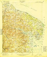
1917 Map of Heathsville
USGS Topo · Published 1917About this map
Heathsville and the surrounding Northern Neck of Virginia are documented here just after the turn of the century, revealing a landscape defined by its intimate relationship with the Potomac River and Chesapeake Bay. The map captures a high density of rural infrastructure, with numerous landings and wharves like Sampsons Wharf and Indian Point Landing serving as vital links for the tidewater economy. This era shows the region before modern bridge networks, where travel was dictated by the complex inlets of the Great Wicomico River and Little Wicomico River.
Find a feature on this map
119 named features on this map. Tap any name to fly to it.
Don’t see what you’re looking for? This feature index may not catch every label — zoom into the map to look around manually.
Map Details
Editions of this 1917 Heathsville Map
4 editions found

Other maps of this area

1892 · Piney Point
USGS Topo · 1:62,500

1894 · Piney Point
USGS Topo · 1:62,500

1894 · Point Lookout
USGS Topo · 1:62,500

1895 · Nomini
USGS Topo · 1:125,000

1895 · Piney Point
USGS Topo · 1:62,500

1898 · Nomini
USGS Topo · 1:125,000

1898 · St. Marys
USGS Topo · 1:125,000

1901 · Piney Point
USGS Topo · 1:62,500

1903 · Bloodsworth Island
USGS Topo · 1:62,500

1906 · St. Marys
USGS Topo · 1:125,000