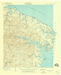
1917 Map of Heathsville
USGS Topo · Published 1960About this map
Heathsville and the surrounding neck lands of Northumberland County are defined by a complex network of tidal creeks and river estuaries during the first decades of the twentieth century. The map illustrates a landscape tied closely to the water, where the Steamboat Route provided essential transport along the Potomac River and Coan River. Coastal settlements such as Reedville, Fleeton, and Lewisetta appear as active centers for the local maritime economy, while inland, a series of family-named mills like Clark Mill and Bush Mill processed the harvests of the rural interior.
Find a feature on this map
107 named features on this map. Tap any name to fly to it.
Don’t see what you’re looking for? This feature index may not catch every label — zoom into the map to look around manually.
Map Details
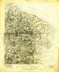
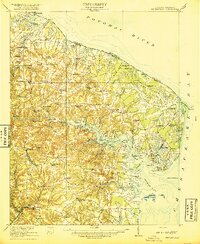
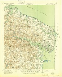
Editions of this 1917 Heathsville Map
4 editions found
Other maps of this area

1892 · Piney Point
USGS Topo · 1:62,500

1894 · Piney Point
USGS Topo · 1:62,500

1894 · Point Lookout
USGS Topo · 1:62,500

1895 · Nomini
USGS Topo · 1:125,000

1895 · Piney Point
USGS Topo · 1:62,500

1898 · Nomini
USGS Topo · 1:125,000

1898 · St. Marys
USGS Topo · 1:125,000

1901 · Piney Point
USGS Topo · 1:62,500

1903 · Bloodsworth Island
USGS Topo · 1:62,500

1906 · St. Marys
USGS Topo · 1:125,000