
1917 Map of Heathsville
USGS Topo · Published 1917About this map
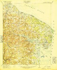
Heathsville and the surrounding peninsulas of the Northern Neck are captured during the First World War in this detailed 1917 survey. The landscape is defined by the complex interlocking shorelines of the Potomac River and Chesapeake Bay, where maritime life is evidenced by the Steamboat Route passing through the Great Wicomico River. Many small agricultural and fishing communities are documented here, including Reedville, Fair Port, and Sunnybank, each linked by primitive roads and local landing points. For genealogists, the map provides a valuable census of local institutions, from Afton Church and Macedonia Church to numerous rural schoolhouses like Martha Coopers School and Shiloh School. The land is divided into distinct necks, such as Bay Quarter Neck and Hull Neck, illustrating how the deeply indented tidal creeks shaped the social and economic geography of Northumberland County before the advent of modern highways.
Find a feature on this map
69 named features on this map. Tap any name to fly to it.
Don’t see what you’re looking for? This feature index may not catch every label — zoom into the map to look around manually.
Map Details
Editions of this 1917 Heathsville Map
4 editions found
Other maps of this area

1892 · Piney Point
USGS Topo · 1:62,500

1894 · Piney Point
USGS Topo · 1:62,500

1894 · Point Lookout
USGS Topo · 1:62,500

1895 · Nomini
USGS Topo · 1:125,000

1895 · Piney Point
USGS Topo · 1:62,500

1898 · Nomini
USGS Topo · 1:125,000

1898 · St. Marys
USGS Topo · 1:125,000

1901 · Piney Point
USGS Topo · 1:62,500

1903 · Bloodsworth Island
USGS Topo · 1:62,500

1906 · St. Marys
USGS Topo · 1:125,000