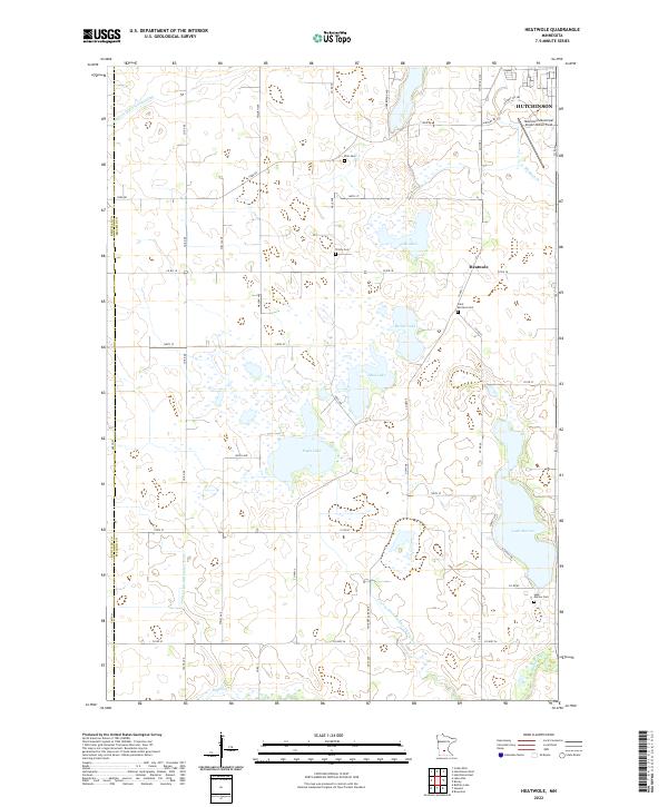
2022 Map of Heatwole
USGS Topo · Published 2022About this map
Hutchinson anchors the northeastern corner of this agricultural landscape in McLeod County, where the city's outskirts meet the expanding Hutchinson Municipal Airport-Butler Field. The surrounding countryside is defined by an intricate network of water management, including the long reaches of Judicial Ditch Number One and County Ditch Number Thirtythree. This drainage system supports a patchwork of farmstead roads like York Rd and Co Rd 18. Smaller settlements like Heatwole appear alongside several significant water bodies, most notably the sprawling Lake Marion and Eagle Lake. The local heritage of the rural community is preserved in several scattered burial grounds, including Zion Cem, Trinity Cem, and Saint Mortens Cem, which serve as quiet landmarks among the fields and marshes of the Minnesota prairie.
Find a feature on this map
35 named features on this map. Tap any name to fly to it.
Don’t see what you’re looking for? This feature index may not catch every label — zoom into the map to look around manually.
Map Details
Editions of this 2022 Heatwole Map
This is the sole edition of this map. No revisions or reprints were ever made.
Other maps of this area

1953 · New Ulm
USGS Topo · 1:250,000

1957 · New Ulm
USGS Topo · 1:250,000

1958 · New Ulm
USGS Topo · 1:250,000

1958 · Winthrop
USGS Topo · 1:62,500

1958 · Hutchinson
USGS Topo · 1:62,500

1964 · Buffalo Lake
USGS Topo · 1:24,000

1967 · New Ulm
USGS Topo · 1:250,000
1967 · Cedar Mills
USGS Topo · 1:24,000
1967 · Lake Allie
USGS Topo · 1:24,000
1982 · Heatwole
USGS Topo · 1:24,000