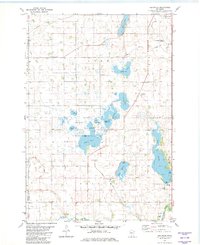
1982 Map of Heatwole
USGS Topo · Published 1982About this map
The lowlands of central Minnesota define this landscape, where the prairie gives way to a dense network of lakes and marshes managed for conservation. At the heart of the area lies the Ras-Lynn Wildlife Management Area, a complex of wetlands including Eagle Lake, Mud Lake, and L Clara that illustrates the regional commitment to habitat preservation. This 1982 survey captures the rural character of Lynn and Collins townships, where small clusters of settlement like Heatwole and West Lynn persist alongside agricultural drainage projects like Judicial Ditch No 1.
Find a feature on this map
35 named features on this map. Tap any name to fly to it.
Don’t see what you’re looking for? This feature index may not catch every label — zoom into the map to look around manually.
Map Details
Editions of this 1982 Heatwole Map
This is the sole edition of this map. No revisions or reprints were ever made.
Other maps of this area

1953 · New Ulm
USGS Topo · 1:250,000

1957 · New Ulm
USGS Topo · 1:250,000

1958 · New Ulm
USGS Topo · 1:250,000

1958 · Winthrop
USGS Topo · 1:62,500

1958 · Hutchinson
USGS Topo · 1:62,500

1964 · Buffalo Lake
USGS Topo · 1:24,000

1967 · New Ulm
USGS Topo · 1:250,000
1967 · Cedar Mills
USGS Topo · 1:24,000
1967 · Lake Allie
USGS Topo · 1:24,000
1982 · Biscay
USGS Topo · 1:24,000