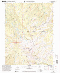
1998 Map of Heber Mountain
USGS Topo · Published 2002About this map
The high mountain watersheds of the Uinta National Forest dominate this late 1990s landscape, where the Uintah and Ouray Indian Reservation Boundary cuts across the ridgelines. High peaks like Heber Mountain and Currant Creek Peak define the hydrological divide, sending water toward the West Fork Duchesne River and the Strawberry River. The topography reveals a complex network of canyons and hollows, including Wide Hollow and Ballows Hollow, which descend from the central uplands toward the valley floors.
Find a feature on this map
25 named features on this map. Tap any name to fly to it.
Don’t see what you’re looking for? This feature index may not catch every label — zoom into the map to look around manually.
Map Details
Editions of this 1998 Heber Mountain Map
This is the sole edition of this map. No revisions or reprints were ever made.
Other maps of this area

1885 · Salt Lake
USGS Topo · 1:250,000

1900 · Coalville
USGS Topo · 1:125,000

1903 · Coalville
USGS Topo · 1:125,000

1907 · Strawberry Valley
USGS Topo · 1:125,000

1909 · Strawberry Valley
USGS Topo · 1:125,000

1954 · Salt Lake City
USGS Topo · 1:250,000

1958 · Salt Lake City
USGS Topo · 1:250,000

1960 · Salt Lake City
USGS Topo · 1:250,000

1967 · Francis
USGS Topo · 1:24,000
1967 · Center Creek
USGS Topo · 1:24,000