
1967 Map of Francis
USGS Topo · Published 1969About this map
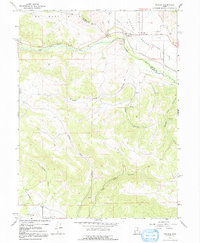
Rhodes Valley serves as a central geographic anchor for this late-1960s survey, where the settlement of Francis sits at the base of The West Hills. The landscape is defined by the vital movement of water, tracing the winding Provo River and the Provo Canal, which are supported by infrastructure such as a Gaging Station and a Water Tank. To the south, the terrain transitions into the upper reaches of Heber Valley, marked by numerous drainage features including Little Pole Canyon and Webb Hollow.
Find a feature on this map
26 named features on this map. Tap any name to fly to it.
Don’t see what you’re looking for? This feature index may not catch every label — zoom into the map to look around manually.
Map Details
Editions of this 1967 Francis Map
2 editions found
Other maps of this area

1885 · Salt Lake
USGS Topo · 1:250,000

1900 · Coalville
USGS Topo · 1:125,000

1903 · Coalville
USGS Topo · 1:125,000

1907 · Strawberry Valley
USGS Topo · 1:125,000

1909 · Strawberry Valley
USGS Topo · 1:125,000

1954 · Salt Lake City
USGS Topo · 1:250,000

1955 · Heber
USGS Topo · 1:24,000

1955 · Park City East
USGS Topo · 1:24,000

1958 · Salt Lake City
USGS Topo · 1:250,000

1960 · Salt Lake City
USGS Topo · 1:250,000