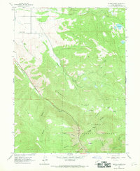
1967 Map of Center Creek
USGS Topo · Published 1969About this map
Heber Valley provides a productive contrast to the steep canyons of the Uinta National Forest in this late 1960s study. The settlement of Center Creek is the primary hub of activity in the northwest, supported by water resources like Lake Creek and industrial features including a Gravel Pit. To the south, the terrain rises sharply into the Hogsback Ridge and the deep cuts of Daniels Canyon, where the Whiskey Spring Picnic Area marks a point of recreational interest along the primary road. The map captures an era of resource management and local infrastructure, shown through the network of telephone lines, pack trails, and isolated forest landmarks like the Hogsback Exclosure. High-altitude water management is evident in the northeast with Witts Lake and Jones Reservoir, while small family-named terrain features such as Clegg Canyon and Cummings Canyon suggest a history of grazing or early land claims.
Find a feature on this map
33 named features on this map. Tap any name to fly to it.
Don’t see what you’re looking for? This feature index may not catch every label — zoom into the map to look around manually.
Map Details
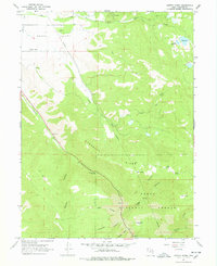
Editions of this 1967 Center Creek Map
2 editions found
Other maps of this area

1885 · Salt Lake
USGS Topo · 1:250,000

1900 · Coalville
USGS Topo · 1:125,000

1903 · Coalville
USGS Topo · 1:125,000

1907 · Strawberry Valley
USGS Topo · 1:125,000

1909 · Strawberry Valley
USGS Topo · 1:125,000

1954 · Salt Lake City
USGS Topo · 1:250,000

1955 · Heber
USGS Topo · 1:24,000

1958 · Salt Lake City
USGS Topo · 1:250,000

1960 · Salt Lake City
USGS Topo · 1:250,000
1966 · Charleston
USGS Topo · 1:24,000