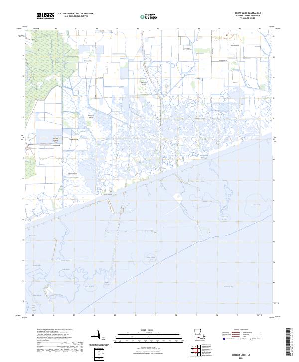
2024 Map of Hebert Lake
USGS Topo · Published 2024About this map
The Vermilion River and the Intracoastal Waterway define the hydraulic character of this coastal Louisiana landscape, where inland bayous meet the expansive Vermilion Bay. This environment is a complex network of marshland and named islands, such as Peter Lee Island, Marklee Island, and Maple Island, which rise above the surrounding wetlands. The map reveals how water management and navigation shaped the region, with the Landry Canal and Four Mile Cutoff providing essential transit routes through the tidal terrain.
Find a feature on this map
47 named features on this map. Tap any name to fly to it.
Don’t see what you’re looking for? This feature index may not catch every label — zoom into the map to look around manually.
Map Details
Editions of this 2024 Hebert Lake Map
This is the sole edition of this map. No revisions or reprints were ever made.
Other maps of this area

1932 · Abbeville SW
USGS Topo · 1:31,680

1932 · Abbeville SE
USGS Topo · 1:31,680

1932 · Abbeville NE
USGS Topo · 1:31,680

1932 · Abbeville NW
USGS Topo · 1:31,680

1937 · Derouen
USGS Topo · 1:62,500

1945 · New Orleans
USGS Topo · 1:250,000

1946 · Redfish Point NE
USGS Topo · 1:31,680

1946 · Redfish Point NW
USGS Topo · 1:31,680

1948 · Cypremort Point
USGS Topo · 1:24,000

1951 · Cheniere Au Tigre
USGS Topo · 1:62,500