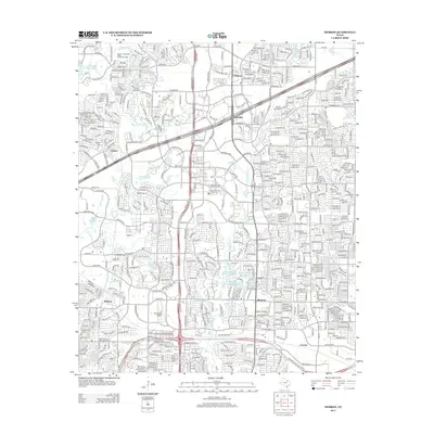
2013 Map of Hebron
USGS Topo · Published 2013About this map
Hebron and Lebanon anchor this detailed survey of the suburban landscape north of Dallas during a period of significant expansion. The map documents the meeting of legacy agricultural history and modern infrastructure, shown through the persistence of small family burial grounds like Sonntag Cem, Baccus Cem, and Bridges Cem amidst a burgeoning network of thoroughfares such as Headquarters Dr and W Plano Pkwy. The drainage of Stewart Creek and White Rock Cr provides the natural framework for the area, which includes man-made water features like Quisenberry Lake and Shirley Phillips Mead Lake. Notable landmarks include the Air Park-Dallas Airport and the Stewart Creek West Water Treatment Facility, illustrating the essential services required for this rapidly developing corridor between Lolaville, Shepton, and Cowley.
Find a feature on this map
35 named features on this map. Tap any name to fly to it.
Don’t see what you’re looking for? This feature index may not catch every label — zoom into the map to look around manually.
Map Details
Editions of this 2013 Hebron Map
This is the sole edition of this map. No revisions or reprints were ever made.
Other maps of this area

1891 · Dallas
USGS Topo · 1:125,000

1893 · Dallas
USGS Topo · 1:125,000

1925 · Mc Kinney 3-c
USGS Topo · 1:48,000

1925 · Dallas 2-b
USGS Topo · 1:48,000

1929 · Frisco
USGS Topo · 1:62,500

1929 · McKinney
USGS Topo · 1:62,500

1931 · Carrollton
USGS Topo · 1:62,500

1954 · Dallas
USGS Topo · 1:250,000

1954 · Sherman
USGS Topo · 1:250,000

1958 · Dallas
USGS Topo · 1:250,000