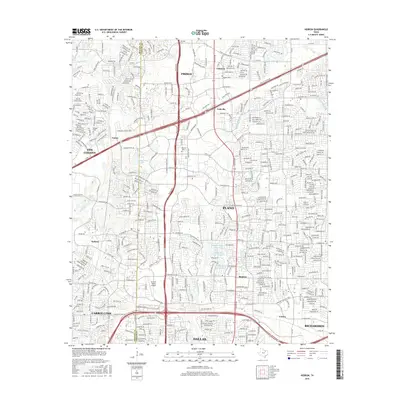
2016 Map of Hebron
USGS Topo · Published 2016About this map
Sonntag Cem, Baccus Cem, and Bridges Cem endure as local historical landmarks amidst the rapid suburban expansion north of Dallas. This map captures a landscape in transition, where the Denton Co and Collin Co border runs through increasingly dense residential developments. Modern transportation corridors like the Dallas Pkwy and Sam Rayburn Tollway facilitate the growth of Frisco, Plano, and Carrollton, while smaller historic place names such as Lebanon, Lolaville, and Camey persist on the map.
Find a feature on this map
35 named features on this map. Tap any name to fly to it.
Don’t see what you’re looking for? This feature index may not catch every label — zoom into the map to look around manually.
Map Details
Editions of this 2016 Hebron Map
This is the sole edition of this map. No revisions or reprints were ever made.
Other maps of this area

1891 · Dallas
USGS Topo · 1:125,000

1893 · Dallas
USGS Topo · 1:125,000

1925 · Mc Kinney 3-c
USGS Topo · 1:48,000

1925 · Dallas 2-b
USGS Topo · 1:48,000

1929 · Frisco
USGS Topo · 1:62,500

1929 · McKinney
USGS Topo · 1:62,500

1931 · Carrollton
USGS Topo · 1:62,500

1954 · Dallas
USGS Topo · 1:250,000

1954 · Sherman
USGS Topo · 1:250,000

1958 · Dallas
USGS Topo · 1:250,000