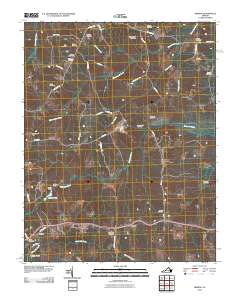
2010 Map of Hebron
USGS Topo · Published 2010About this map
Ammon and Wilsons anchor this rural landscape in Amelia County, characterized by a dense distribution of family burial grounds and small agricultural settlements. The terrain is defined by the branching waterways of Winticomack Creek, Namozine Creek, and White Oak Creek, which have historically shaped local land use and boundaries. Significant for genealogists and local historians, the area is dotted with numerous family-named landmarks including Craddock Cemetery, Hamner Cemetery, and Oliver Cemetery. The presence of Hobbs Mill near Hobbs Pond points to the early water-powered industry that once supported these farming communities. This record illustrates the enduring rural character of south-central Virginia, where the network of local roads like Richmond Rd and Namozine Rd connects dispersed homesteads and long-established community centers such as Harris Store.
Find a feature on this map
51 named features on this map. Tap any name to fly to it.
Don’t see what you’re looking for? This feature index may not catch every label — zoom into the map to look around manually.
Map Details
Editions of this 2010 Hebron Map
This is the sole edition of this map. No revisions or reprints were ever made.
Other maps of this area

1897 · Amelia
USGS Topo · 1:125,000

1943 · Amelia
USGS Topo · 1:31,680

1943 · Goodes Bridge
USGS Topo · 1:31,680

1943 · De Witt
USGS Topo · 1:24,000

1943 · Church Road
USGS Topo · 1:24,000

1943 · Winterpock
USGS Topo · 1:24,000

1943 · Richmond
USGS Topo · 1:250,000
1944 · Winterpock
USGS Topo · 1:31,680
1944 · Church Road
USGS Topo · 1:31,680
1944 · DeWitt
USGS Topo · 1:31,680