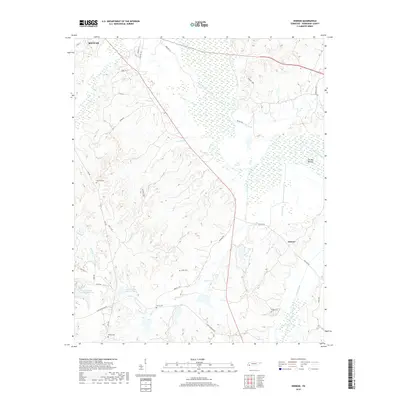
2019 Map of Hebron
USGS Topo · Published 2019About this map
Hebron sits amidst a landscape defined by the winding Hatchie River and its numerous tributaries in this modern topographic survey. The area exhibits a pattern of rural land use where low-lying wetlands like The Big Bottom contrast with the higher elevations where many of the region's historic landmarks are situated. Genealogists will find several burial grounds across the quadrangle, including Salem Cem, Harris Cem, and Oak Hill Cem, documenting the long-standing family ties to the Hardeman County countryside. The southern portion of the map is characterized by water management and recreation at Grand Valley Lake Number Two and Cub Cr Lake Number Three. A network of country roads, such as Pea Vine Rd and Maxwell Rd, connects the scattered farmsteads and small settlements to Bolivar in the northwest corner.
Find a feature on this map
37 named features on this map. Tap any name to fly to it.
Don’t see what you’re looking for? This feature index may not catch every label — zoom into the map to look around manually.
Map Details
Editions of this 2019 Hebron Map
This is the sole edition of this map. No revisions or reprints were ever made.
Other maps of this area

1950 · Pocahontas
USGS Topo · 1:24,000

1950 · Hebron
USGS Topo · 1:24,000

1950 · Hornsby
USGS Topo · 1:24,000

1950 · Middleburg
USGS Topo · 1:24,000

1950 · Middleton
USGS Topo · 1:24,000

1951 · Middleton
USGS Topo · 1:24,000

1951 · Middleburg
USGS Topo · 1:24,000

1951 · Hebron
USGS Topo · 1:24,000

1951 · Hornsby
USGS Topo · 1:24,000

1952 · Pocahontas
USGS Topo · 1:24,000