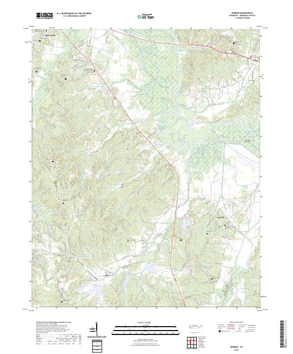
2022 Map of Hebron
USGS Topo · Published 2022About this map
The Hatchie River and its wide, marshy floodplain dominate this West Tennessee landscape, creating a distinct boundary between the elevated ridges and the lowlands of The Big Bottom. In the northern corner, the outskirts of Bolivar transition into a rural network of family farms and cemeteries. This 2022 survey reveals a high density of small burial grounds and rural churches, such as Rehobeth Church Cem near the small settlement of Hebron and Campbell Chapel Missionary Baptist Church Cem. The terrain is deeply etched by a system of creeks including Porters Creek, Deadman Br, and Dru Br, which feed the river basin. Modern developments like Grand Valley Lake Number Two sit alongside historic sites like the Salem Cem and Oak Hill Cem, showing the continued evolution of Hardeman County's land use.
Find a feature on this map
91 named features on this map. Tap any name to fly to it.
Don’t see what you’re looking for? This feature index may not catch every label — zoom into the map to look around manually.
Map Details
Editions of this 2022 Hebron Map
This is the sole edition of this map. No revisions or reprints were ever made.
Other maps of this area

1950 · Pocahontas
USGS Topo · 1:24,000

1950 · Hebron
USGS Topo · 1:24,000

1950 · Hornsby
USGS Topo · 1:24,000

1950 · Middleburg
USGS Topo · 1:24,000

1950 · Middleton
USGS Topo · 1:24,000

1951 · Middleton
USGS Topo · 1:24,000

1951 · Middleburg
USGS Topo · 1:24,000

1951 · Hebron
USGS Topo · 1:24,000

1951 · Hornsby
USGS Topo · 1:24,000

1952 · Pocahontas
USGS Topo · 1:24,000