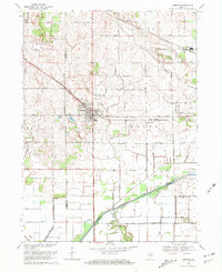
1969 Map of Hebron
USGS Topo · Published 1971About this map
Hebron serves as the central hub of this 1969 landscape, where the Penn Central rail line cuts diagonally through the terrain. The region is defined by an extensive network of drainage ditches such as Cornell Ditch and Breyfogel Ditch, illustrating the mid-century agricultural effort to manage the marshy lowlands near the Kankakee River. To the south, the Brown Levee stands as a significant engineering feature protecting the fertile bottomlands of Eagle Creek and Wheatfield. For local historians, the map preserves the exact positions of the Hebron Cem and Cornell Cem, along with smaller communities like Boone Grove and Hurlburt. The intersection of the Erie-Lackawanna railroad and the various county roads reveals a transition from rail-dependent commerce to a modernizing rural road grid.
Find a feature on this map
43 named features on this map. Tap any name to fly to it.
Don’t see what you’re looking for? This feature index may not catch every label — zoom into the map to look around manually.
Map Details
Editions of this 1969 Hebron Map
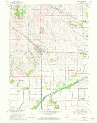
2 editions found
Other maps of this area

1953 · Leroy
USGS Topo · 1:24,000

1953 · Palmer
USGS Topo · 1:24,000

1953 · Crown Point
USGS Topo · 1:24,000

1953 · Hebron
USGS Topo · 1:24,000

1953 · Valparaiso
USGS Topo · 1:24,000

1953 · Kouts
USGS Topo · 1:24,000

1953 · Chicago
USGS Topo · 1:250,000

1957 · Chicago
USGS Topo · 1:250,000

1957 · Wheatfield
USGS Topo · 1:24,000

1957 · DeMotte
USGS Topo · 1:24,000