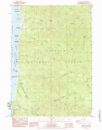
1984 Map of Heceta Head
USGS Topo · Published 1984About this map
Heceta Head Light House and the adjacent US Coast Guard Reservation stand at the southern edge of this coastal landscape, guarding the rugged Pacific shoreline where the Oregon Coast Highway winds through a series of state-managed lands. This 1980s-era survey documents a stretch of the Siuslaw National Forest defined by steep ridges and numerous drainage systems, including Tenmile Creek, Big Creek, and Cape Creek. The settlement pattern is sparse, centered on Searose Beach and a small Trailer Court, illustrating the transition toward conservation and recreation along the Oregon coast.
Find a feature on this map
54 named features on this map. Tap any name to fly to it.
Don’t see what you’re looking for? This feature index may not catch every label — zoom into the map to look around manually.
Map Details
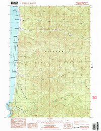
Editions of this 1984 Heceta Head Map
2 editions found
Other maps of this area

1918 · Mapleton
USGS Topo · 1:48,000

1920 · Heceta Head
USGS Topo · 1:62,500

1922 · Waldport
USGS Topo · 1:62,500

1940 · Mapleton
USGS Topo · 1:62,500

1942 · Waldport
USGS Topo · 1:62,500

1942 · Heceta Head
USGS Topo · 1:62,500

1942 · Tidewater
USGS Topo · 1:62,500

1945 · Mapleton
USGS Topo · 1:62,500

1953 · Salem
USGS Topo · 1:250,000

1954 · Salem
USGS Topo · 1:250,000