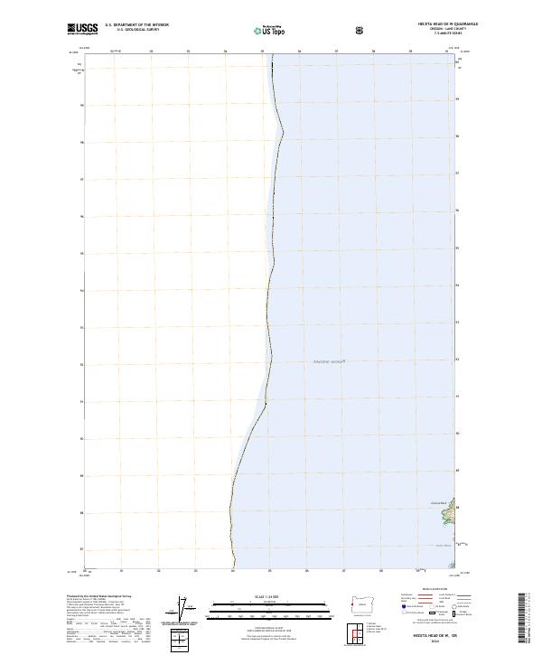
2024 Map of Heceta Head OE W
USGS Topo · Published 2024About this map
Oregon Islands National Wildlife Refuge anchors the southern coastline of this map, where the continent meets the expansive Pacific Ocean. This coastal segment of Lane County is defined by its protected environments and marine geography, including the offshore reaches of the Oregon Islands Wilderness. Significant landmarks such as Conical Rock and the shoreline at Devils Elbow offer precise points of reference for researchers and surveyors tracing the maritime boundary of western Oregon. The map serves as a detailed record of land use and conservation status as of the early 2020s, showing the intersection of Township 16 South, Range 12 West with the Pacific shoreline.
Find a feature on this map
6 named features on this map. Tap any name to fly to it.
Don’t see what you’re looking for? This feature index may not catch every label — zoom into the map to look around manually.
Map Details
Editions of this 2024 Heceta Head OE W Map
This is the sole edition of this map. No revisions or reprints were ever made.
Other maps of this area

1920 · Heceta Head
USGS Topo · 1:62,500

1922 · Waldport
USGS Topo · 1:62,500

1942 · Waldport
USGS Topo · 1:62,500

1942 · Heceta Head
USGS Topo · 1:62,500

1953 · Salem
USGS Topo · 1:250,000

1954 · Salem
USGS Topo · 1:250,000
1956 · Heceta Head
USGS Topo · 1:62,500

1956 · Waldport
USGS Topo · 1:62,500

1960 · Salem
USGS Topo · 1:250,000

1962 · Salem
USGS Topo · 1:250,000