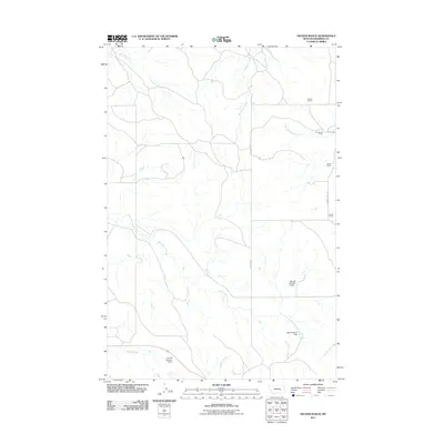
2011 Map of Hecker Ranch
USGS Topo · Published 2011About this map
Isolated ranching operations and seasonal camps define this section of the Montana high plains during the early 21st century. The landscape is oriented around ephemeral water sources and drainage systems, where family names are etched into the map through locations such as Hecker Ranch and Hauck Ranch. These headquarters are supported by critical water management infrastructure, including the Schmidt Number 1 Dam and BN Number 3 Dam, which allow for cattle grazing in a semi-arid environment. Movement through this Rosebud County territory relies on a sparse network of unpaved roads like Sumatra Rd and Gumbo Butte Rd. The geography is further marked by Kincheloe Camp and Rankin Camp, indicating the specialized land use required to manage vast acreages far from established towns. These settlements follow the natural contours of Rattlesnake Creek and Antelope Creek, which provide the primary topographic structure for the region.
Find a feature on this map
20 named features on this map. Tap any name to fly to it.
Don’t see what you’re looking for? This feature index may not catch every label — zoom into the map to look around manually.
Map Details
Editions of this 2011 Hecker Ranch Map
This is the sole edition of this map. No revisions or reprints were ever made.
Other maps of this area

1954 · Forsyth
USGS Topo · 1:250,000

1957 · Forsyth
USGS Topo · 1:250,000

1958 · Forsyth
USGS Topo · 1:250,000

1960 · Yablonski Ranch
USGS Topo · 1:24,000

1960 · Ingomar West
USGS Topo · 1:24,000

1962 · Guthridge Ranch
USGS Topo · 1:24,000

1962 · Sumatra
USGS Topo · 1:24,000

1962 · Kincheloe Ranch
USGS Topo · 1:24,000

1962 · Grebe Ranch
USGS Topo · 1:24,000

1963 · Hecker Ranch
USGS Topo · 1:24,000