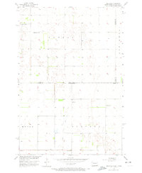
1956 Map of Hecla NE
USGS Topo · Published 1974About this map
Agricultural patterns and water management define this landscape at the border of North Dakota and South Dakota during the mid-1950s. The terrain is marked by township divisions such as Lovell, Hecla, and Portage, illustrating the structured settlement of the Great Plains. Local education was decentralized, as evidenced by several rural schoolhouses serving the farming community, including Eaton Sch No 2, Tiry Sch, Pearson Sch, and Johnson Sch.
Find a feature on this map
13 named features on this map. Tap any name to fly to it.
Don’t see what you’re looking for? This feature index may not catch every label — zoom into the map to look around manually.
Map Details
Editions of this 1956 Hecla NE Map
3 editions found
Other maps of this area

1894 · Hecla
USGS Topo · 1:62,500

1894 · Oakes
USGS Topo · 1:62,500

1895 · Lamoure
USGS Topo · 1:125,000

1896 · Columbia
USGS Topo · 1:125,000

1918 · La Moure
USGS Topo · 1:125,000

1953 · Jamestown
USGS Topo · 1:250,000

1953 · Hecla SE
USGS Topo · 1:24,000

1953 · Houghton
USGS Topo · 1:24,000

1953 · Newark SW
USGS Topo · 1:24,000

1953 · Milbank
USGS Topo · 1:250,000