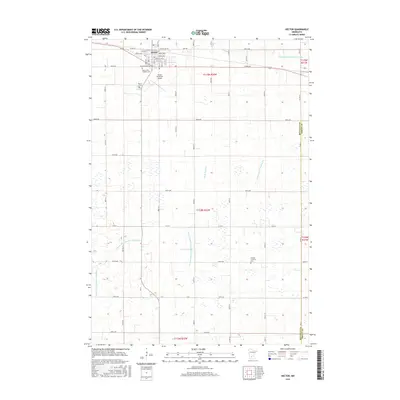
2016 Map of Hector
USGS Topo · Published 2016About this map
The prairie town of Hector stands as a focal point in this portion of Renville County, organized around a structured grid of residential streets including Birch Ave E, Cedar Ave E, and Ash Ave W. This landscape is defined by its extensive agricultural drainage system, a network of engineered waterways such as County Ditch Number One Hundred Three, County Ditch Number Six, and Judicial Ditch Number Fifteen. These features, alongside the meandering path of High Island Cr, illustrate the region's long-standing commitment to land reclamation for farming. Local history and genealogy are preserved in the community's burial grounds, including the Saint John's Catholic Cem, Hector Cem, and the German Lutheran Cem found further south. The Hector Municipal Airport marks the modern transportation infrastructure that complements the regional road network of Co Rd 4 and 740th Ave.
Find a feature on this map
38 named features on this map. Tap any name to fly to it.
Don’t see what you’re looking for? This feature index may not catch every label — zoom into the map to look around manually.
Map Details
Editions of this 2016 Hector Map
This is the sole edition of this map. No revisions or reprints were ever made.
Other maps of this area

1952 · Morton
USGS Topo · 1:62,500

1953 · New Ulm
USGS Topo · 1:250,000

1957 · New Ulm
USGS Topo · 1:250,000

1957 · Olivia
USGS Topo · 1:62,500

1958 · New Ulm
USGS Topo · 1:250,000

1964 · Fairfax
USGS Topo · 1:24,000

1964 · Buffalo Lake
USGS Topo · 1:24,000

1964 · Hector
USGS Topo · 1:24,000

1964 · Gibbon
USGS Topo · 1:24,000

1967 · New Ulm
USGS Topo · 1:250,000