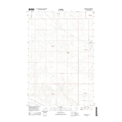
2014 Map of Hedgesville
USGS Topo · Published 2014About this map
Hedgesville sits near the eastern edge of this Wheatland County landscape, where the prairie begins to break into the drainage systems of the Musselshell River. The southern portion of the sheet is defined by the critical water infrastructure of the Deadmans Basin Supply Canal, which draws from the river to support the region's agricultural needs. This 2014 survey documents a terrain shaped by numerous intermittent waterways, including Alkali Cr, Roberts Cr, and Elk Cr, which carve paths through the high plains toward the Musselshell valley.
Find a feature on this map
18 named features on this map. Tap any name to fly to it.
Don’t see what you’re looking for? This feature index may not catch every label — zoom into the map to look around manually.
Map Details
Editions of this 2014 Hedgesville Map
This is the sole edition of this map. No revisions or reprints were ever made.
Other maps of this area

1889 · Big Snowy Mountain
USGS Topo · 1:250,000

1893 · Big Snowy Mountain
USGS Topo · 1:250,000

1954 · Roundup
USGS Topo · 1:250,000

1958 · Roundup
USGS Topo · 1:250,000

1986 · Shawmut
USGS Topo · 1:24,000

1986 · Halbert Creek South
USGS Topo · 1:24,000
1986 · Deadmans Basin Reservoir
USGS Topo · 1:24,000
1986 · Devils Pocket
USGS Topo · 1:24,000

1986 · Halbert Creek North
USGS Topo · 1:24,000
1986 · Oxford
USGS Topo · 1:24,000