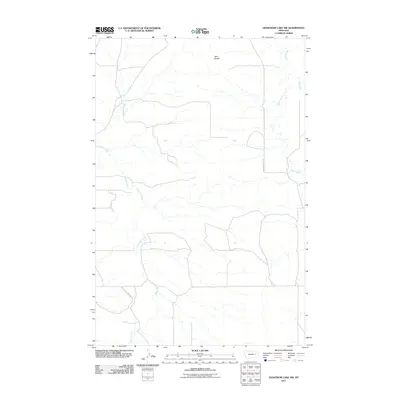
2011 Map of Hedstrom Lake NW
USGS Topo · Published 2011About this map
Whiteside Ranch and the community of Sleepy Hollow anchor this sparsely populated section of McCone County, where the landscape is defined by the ephemeral drainages of the Big Dry Creek watershed. The network of seasonal watercourses includes Little Dry Creek, Timber Creek, and Jones Creek, which carve across the prairie towards the Twin Buttes landmark. A notable human intervention in this arid environment is the Little Dry Users Ditch, which reflects the region's historical reliance on managed water systems for ranching and agriculture. Local education history is preserved in the location of the Tree Coulee School, while S Flowing Wells Rd provides the primary north-south transit through the rolling hills and coulees of this cattle-ranching territory.
Find a feature on this map
10 named features on this map. Tap any name to fly to it.
Don’t see what you’re looking for? This feature index may not catch every label — zoom into the map to look around manually.
Map Details
Editions of this 2011 Hedstrom Lake NW Map
This is the sole edition of this map. No revisions or reprints were ever made.
Other maps of this area

1954 · Jordan
USGS Topo · 1:250,000

1956 · Jordan
USGS Topo · 1:250,000

1958 · Jordan
USGS Topo · 1:250,000

1964 · Jordan
USGS Topo · 1:250,000

1965 · Hedstrom Lake
USGS Topo · 1:24,000

1965 · Hedstrom Lake SE
USGS Topo · 1:24,000

1965 · Whiteside Ranch
USGS Topo · 1:24,000
1965 · Tree Coulee School
USGS Topo · 1:24,000

1965 · Hedstrom Lake NW
USGS Topo · 1:24,000
1965 · Sleepy Hollow
USGS Topo · 1:24,000