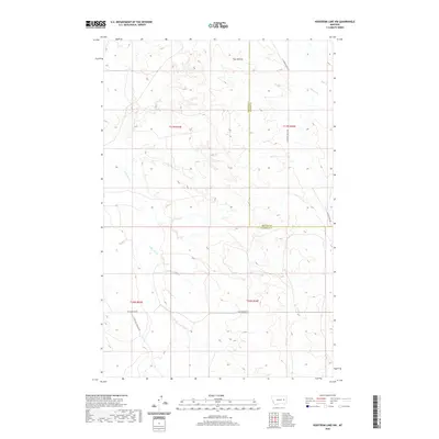
2020 Map of Hedstrom Lake NW
USGS Topo · Published 2020About this map
Twin Buttes rises above a landscape defined by the intersection of Garfield and McCone counties in eastern Montana. This area is shaped by a network of intermittent waterways, including the winding course of Little Dry Cr and the specialized Little Dry Users Ditch, which suggest a history of managed water use in this semi-arid terrain. Transportation is limited to functional routes like Two Furrows Rd and S Flowing Wells Rd, reflecting a low-density ranching or agricultural environment where infrastructure is tailored to the needs of the land. The presence of several named drainages, such as Timber Cr and Jones Cr, further highlights how the natural topography dictates the settlement and movement patterns within this section of the state.
Find a feature on this map
16 named features on this map. Tap any name to fly to it.
Don’t see what you’re looking for? This feature index may not catch every label — zoom into the map to look around manually.
Map Details
Editions of this 2020 Hedstrom Lake NW Map
This is the sole edition of this map. No revisions or reprints were ever made.
Other maps of this area

1954 · Jordan
USGS Topo · 1:250,000

1956 · Jordan
USGS Topo · 1:250,000

1958 · Jordan
USGS Topo · 1:250,000

1964 · Jordan
USGS Topo · 1:250,000

1965 · Hedstrom Lake
USGS Topo · 1:24,000

1965 · Hedstrom Lake SE
USGS Topo · 1:24,000

1965 · Whiteside Ranch
USGS Topo · 1:24,000
1965 · Tree Coulee School
USGS Topo · 1:24,000

1965 · Hedstrom Lake NW
USGS Topo · 1:24,000
1965 · Sleepy Hollow
USGS Topo · 1:24,000