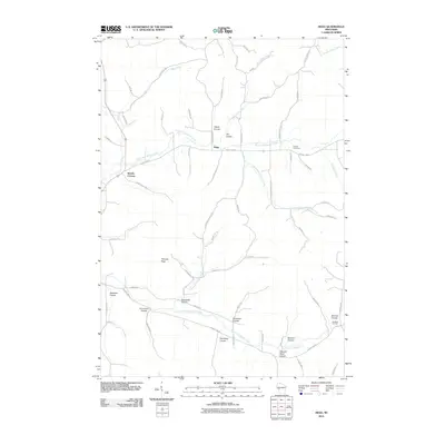
2010 Map of Hegg
USGS Topo · Published 2010About this map
Hegg lies at the geographic center of this Jackson County landscape, where the drainage of the North Fork Beaver Creek and South Fork Beaver Creek defines the valley floor. The map reflects a deeply dissected topography of named coulees, a term characteristic of this region's glacial history. These narrow valleys, including Legue Coulee, Joe Coulee, and German Coulee, dictated the placement of homesteads and early farm-to-market roads. Cultural landmarks like Pioneer Cemetery and small junctions at Beachs Corners and Buckholz Corners anchor the rural community. The presence of high points such as Thimble Peak provides a contrast to the complex network of creeks like Washington Coulee Creek and Salzwedel Coulee Creek that wind through the lowlands, illustrating a settlement pattern governed strictly by the water and the ridges.
Find a feature on this map
68 named features on this map. Tap any name to fly to it.
Don’t see what you’re looking for? This feature index may not catch every label — zoom into the map to look around manually.
Map Details
Editions of this 2010 Hegg Map
This is the sole edition of this map. No revisions or reprints were ever made.
Other maps of this area

1926 · North Bend
USGS Topo · 1:62,500

1926 · Whitehall
USGS Topo · 1:62,500

1927 · Blair
USGS Topo · 1:62,500

1929 · Whitehall
USGS Topo · 1:62,500

1929 · Galesville
USGS Topo · 1:62,500

1929 · North Bend
USGS Topo · 1:62,500

1953 · Eau Claire
USGS Topo · 1:250,000

1958 · Eau Claire
USGS Topo · 1:250,000

1964 · Eau Claire
USGS Topo · 1:250,000
1968 · Blair
USGS Topo · 1:62,500