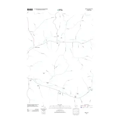
2013 Map of Hegg
USGS Topo · Published 2013About this map
Hegg serves as a central point in this rural landscape, situated where the northern and southern forks of the local creek systems define the terrain. The map details a complex network of coulees, a characteristic regional landform, many of which bear the names of early settler families. Features such as Legue Coulee, Stensven Coulee, and Svenson Coulee suggest a deep history of homesteading and land tenure. These valleys are drained by the N Fork Beaver Cr and S Fork Beaver Cr, which converge to the west.
Find a feature on this map
72 named features on this map. Tap any name to fly to it.
Don’t see what you’re looking for? This feature index may not catch every label — zoom into the map to look around manually.
Map Details
Editions of this 2013 Hegg Map
This is the sole edition of this map. No revisions or reprints were ever made.
Other maps of this area

1926 · North Bend
USGS Topo · 1:62,500

1926 · Whitehall
USGS Topo · 1:62,500

1927 · Blair
USGS Topo · 1:62,500

1929 · Whitehall
USGS Topo · 1:62,500

1929 · Galesville
USGS Topo · 1:62,500

1929 · North Bend
USGS Topo · 1:62,500

1953 · Eau Claire
USGS Topo · 1:250,000

1958 · Eau Claire
USGS Topo · 1:250,000

1964 · Eau Claire
USGS Topo · 1:250,000
1968 · Blair
USGS Topo · 1:62,500