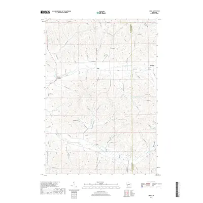
2018 Map of Hegg
USGS Topo · Published 2018About this map
Deeply incised coulees and narrow ridges define this portion of the Driftless Area along the border of Jackson Co and Trempealeau Co. Small settlements like Hegg and Franklin are situated near the headwaters of the N Fork Beaver Cr, while Beachs Corners serves as a junction for local travel. The landscape is characterized by its numerous named valleys, including Joe Coulee and Borreson Coulee, which dictate the winding paths of rural roads like Lunde Coulee Ln and Peacock Road Coulee. The topographic prominence of Thimble Peak stands as a notable landmark amidst the complex drainage network of the S Fork Beaver Cr. Local history is preserved at the Pioneer Cem near the eastern edge of the quadrangle, illustrating the early settlement patterns of these protected valleys.
Find a feature on this map
93 named features on this map. Tap any name to fly to it.
Don’t see what you’re looking for? This feature index may not catch every label — zoom into the map to look around manually.
Map Details
Editions of this 2018 Hegg Map
This is the sole edition of this map. No revisions or reprints were ever made.
Other maps of this area

1926 · North Bend
USGS Topo · 1:62,500

1926 · Whitehall
USGS Topo · 1:62,500

1927 · Blair
USGS Topo · 1:62,500

1929 · Whitehall
USGS Topo · 1:62,500

1929 · Galesville
USGS Topo · 1:62,500

1929 · North Bend
USGS Topo · 1:62,500

1953 · Eau Claire
USGS Topo · 1:250,000

1958 · Eau Claire
USGS Topo · 1:250,000

1964 · Eau Claire
USGS Topo · 1:250,000
1968 · Blair
USGS Topo · 1:62,500