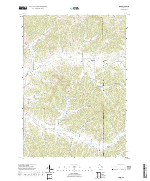
2022 Map of Hegg
USGS Topo · Published 2022About this map
The community of Hegg sits at the heart of this Trempealeau County survey, where the Driftless Area landscape is defined by its deep, named coulees. Valleys like Leque Coulee, Salzwedel Coulee, and German Coulee drain toward the N Fork Beaver Cr and S Fork Beaver Cr, creating a highly dissected terrain that shaped local settlement patterns. Significant family-named landmarks and rural institutions are well-preserved, from the Thimble Peak elevation to the various Lutheran congregations that served the area's Norwegian-American heritage.
Find a feature on this map
101 named features on this map. Tap any name to fly to it.
Don’t see what you’re looking for? This feature index may not catch every label — zoom into the map to look around manually.
Map Details
Editions of this 2022 Hegg Map
This is the sole edition of this map. No revisions or reprints were ever made.
Other maps of this area

1926 · North Bend
USGS Topo · 1:62,500

1926 · Whitehall
USGS Topo · 1:62,500

1927 · Blair
USGS Topo · 1:62,500

1929 · Whitehall
USGS Topo · 1:62,500

1929 · Galesville
USGS Topo · 1:62,500

1929 · North Bend
USGS Topo · 1:62,500

1953 · Eau Claire
USGS Topo · 1:250,000

1958 · Eau Claire
USGS Topo · 1:250,000

1964 · Eau Claire
USGS Topo · 1:250,000
1968 · Blair
USGS Topo · 1:62,500