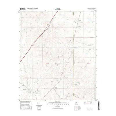
2015 Map of Heidelberg
USGS Topo · Published 2015About this map
Heidelberg anchors this portion of Jasper County, where the town grid is clearly defined by streets like Beech St, Walnut St, and Magnolia Ave. The landscape follows the drainage of Bogue Homo and Shubuta Creek, revealing a series of small communities and rural family landmarks. Moving north and east, the map traces the locations of Vossburg, Stafford Springs, and Barnett along the transport corridors between Jasper and Clarke counties. Genealogists will find significant value in the distribution of local burial grounds, including Salem Cem, Saint Peter Cem, and Shady Grove Cem. The area's water resources are punctuated by several named bodies of water such as Lake Utopia, Lake Waukaway, and Lake Bounds, illustrating the local hydrology that historically influenced settlement patterns in this part of Mississippi.
Find a feature on this map
56 named features on this map. Tap any name to fly to it.
Don’t see what you’re looking for? This feature index may not catch every label — zoom into the map to look around manually.
Map Details
Editions of this 2015 Heidelberg Map
This is the sole edition of this map. No revisions or reprints were ever made.
Other maps of this area

1953 · Hattiesburg
USGS Topo · 1:250,000

1953 · Meridian
USGS Topo · 1:250,000

1957 · Meridian
USGS Topo · 1:250,000

1957 · Enterprise
USGS Topo · 1:62,500

1958 · Hattiesburg
USGS Topo · 1:250,000

1963 · Waldrup
USGS Topo · 1:24,000

1963 · Heidelberg
USGS Topo · 1:24,000

1964 · Heidelberg SW
USGS Topo · 1:24,000

1964 · Sandersville
USGS Topo · 1:24,000

1964 · Eucutta
USGS Topo · 1:24,000