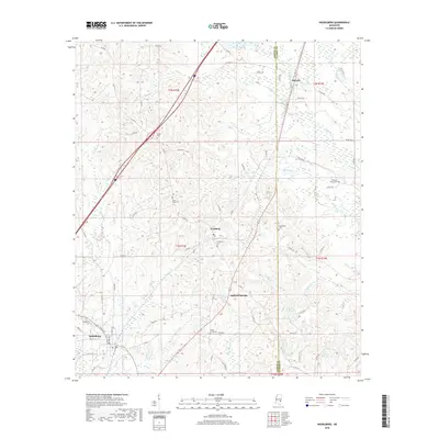
2018 Map of Heidelberg
USGS Topo · Published 2018About this map
Heidelberg and Vossburg anchor this survey of the East Mississippi landscape, where the rural topography is defined by the headwaters of the Pascagoula River basin. The settlement pattern follows the high ground between numerous drainage systems, including Bogue Homo and Beaver Cr. Genealogists will find a high density of burial sites across the quadrangle, from the Salem Cem in the north to the Shady Grove Cem near the southern boundary. The presence of Stafford Springs points to the area's legacy of mineral springs, while modern infrastructure like Interstate 59 now cuts through the traditional land divisions of T1N and T2N. Local recreation is centered around Lake Wauka-way and Lake Bounds, situated among the creek flats of the Jasper and Clarke County line.
Find a feature on this map
67 named features on this map. Tap any name to fly to it.
Don’t see what you’re looking for? This feature index may not catch every label — zoom into the map to look around manually.
Map Details
Editions of this 2018 Heidelberg Map
This is the sole edition of this map. No revisions or reprints were ever made.
Other maps of this area

1953 · Hattiesburg
USGS Topo · 1:250,000

1953 · Meridian
USGS Topo · 1:250,000

1957 · Meridian
USGS Topo · 1:250,000

1957 · Enterprise
USGS Topo · 1:62,500

1958 · Hattiesburg
USGS Topo · 1:250,000

1963 · Waldrup
USGS Topo · 1:24,000

1963 · Heidelberg
USGS Topo · 1:24,000

1964 · Heidelberg SW
USGS Topo · 1:24,000

1964 · Sandersville
USGS Topo · 1:24,000

1964 · Eucutta
USGS Topo · 1:24,000