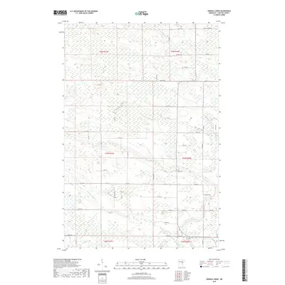
2019 Map of Heikkila Creek
USGS Topo · Published 2019About this map
The Kettle River and its various tributaries define this northern landscape in Carlton County. Flowing through the southern half of the quadrangle, the river is joined by the W Br Kettle River and the Dead Moose River, creating a complex network of waterways that likely supported early logging and transport. The grid of rural roads, including Pallo Rd and Manni Rd, connects isolated farmsteads and family settlements. For genealogists, the map is a significant resource, identifying specific local burial sites such as West Branch Cem, the Co-op Cem, and Holy Trinity Cem. These features, along with names like Stenberg Rd and Korpi Rd, reflect the cultural heritage and familial ties that shaped this part of Minnesota. The terrain is characterized by numerous small creeks and drainages, including Heikkila Cr and Silver Cr, which wind through the township boundaries.
Find a feature on this map
52 named features on this map. Tap any name to fly to it.
Don’t see what you’re looking for? This feature index may not catch every label — zoom into the map to look around manually.
Map Details
Editions of this 2019 Heikkila Creek Map
This is the sole edition of this map. No revisions or reprints were ever made.
Other maps of this area

1953 · Duluth
USGS Topo · 1:250,000

1958 · Duluth
USGS Topo · 1:250,000

1961 · Cromwell
USGS Topo · 1:62,500

1961 · Moose Lake
USGS Topo · 1:62,500

1969 · Ronald
USGS Topo · 1:24,000

1969 · Automba
USGS Topo · 1:24,000

1970 · Wright
USGS Topo · 1:24,000

1980 · Sandstone
USGS Topo · 1:100,000

1980 · Duluth
USGS Topo · 1:100,000

1981 · Kettle River
USGS Topo · 1:24,000
Featured Places
- Kalevala Township, MN
- Split Rock Township, MN
- Silver Township, MN
- Lakeview Township, MN
- Automba Township, MN