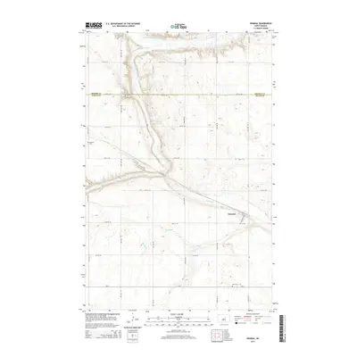
2014 Map of Heimdal
USGS Topo · Published 2014About this map
The Sheyenne River winds through the northern portion of this landscape, joined by its N Fork Sheyenne River as it carves through the central North Dakota plains. This 2014 survey documents the small settlement of Heimdal, located where the local road network of Highland St and 1st Ave meets the sweeping marshes of the Big Slough. The area's agricultural and social history is anchored by long-standing landmarks such as Bethania Cem in the west and Hoff Cem along the southern boundary. Straddling the line between Benson Co and Wells Co, the map illustrates a sparse but organized rural grid of section-line roads, revealing the enduring settlement patterns of the region's late-twentieth-century farming economy.
Find a feature on this map
19 named features on this map. Tap any name to fly to it.
Don’t see what you’re looking for? This feature index may not catch every label — zoom into the map to look around manually.
Map Details
Editions of this 2014 Heimdal Map
This is the sole edition of this map. No revisions or reprints were ever made.
Other maps of this area

1941 · Selz
USGS Topo · 1:62,500

1943 · Maddock
USGS Topo · 1:62,500

1945 · Maddock
USGS Topo · 1:62,500

1945 · Manfred
USGS Topo · 1:62,500

1948 · Fessenden
USGS Topo · 1:62,500

1948 · Manfred
USGS Topo · 1:62,500

1949 · Fessenden East
USGS Topo · 1:24,000

1949 · Fessenden West
USGS Topo · 1:24,000

1950 · Wellsburg
USGS Topo · 1:24,000

1950 · Manfred
USGS Topo · 1:24,000