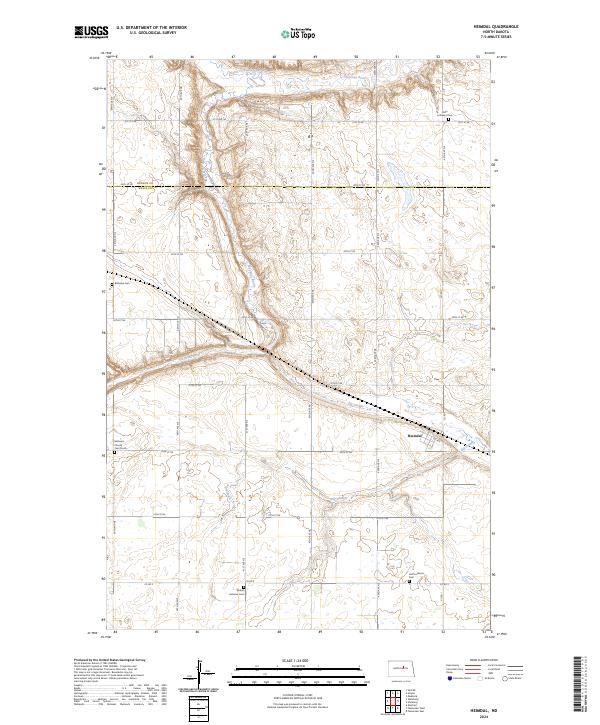
2024 Map of Heimdal
USGS Topo · Published 2024About this map
Heimdal sits at the heart of this rural landscape where the border of Benson Co and Wells Co meets. The terrain is defined by the winding course of the Sheyenne River and its North Fork Sheyenne River to the north, while the southern reaches are marked by the extensive lowlands of the Big Slough. This area is particularly dense with sites of interest for family historians, as it preserves the locations of numerous dispersed burial grounds and congregations serving the early farming communities.
Find a feature on this map
35 named features on this map. Tap any name to fly to it.
Don’t see what you’re looking for? This feature index may not catch every label — zoom into the map to look around manually.
Map Details
Editions of this 2024 Heimdal Map
This is the sole edition of this map. No revisions or reprints were ever made.
Other maps of this area

1941 · Selz
USGS Topo · 1:62,500

1943 · Maddock
USGS Topo · 1:62,500

1945 · Maddock
USGS Topo · 1:62,500

1945 · Manfred
USGS Topo · 1:62,500

1948 · Fessenden
USGS Topo · 1:62,500

1948 · Manfred
USGS Topo · 1:62,500

1949 · Fessenden East
USGS Topo · 1:24,000

1949 · Fessenden West
USGS Topo · 1:24,000

1950 · Wellsburg
USGS Topo · 1:24,000

1950 · Manfred
USGS Topo · 1:24,000