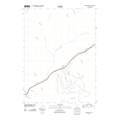
2010 Map of Heiners Creek
USGS Topo · Published 2010About this map
Emory sits at the intersection of significant geographical pathways, where the waters of Heiners Creek and Echo Creek meet amidst a network of deep drainages. This high-altitude landscape is defined by the narrow corridor of Echo Canyon, a historic transit route through the mountains that continues to serve as a primary transportation artery. The mapping reveals a complex topography of named canyons such as Sawmill Canyon and Lord Canyon, suggesting a history of local industry and resource extraction tied to the rugged terrain.
Find a feature on this map
38 named features on this map. Tap any name to fly to it.
Don’t see what you’re looking for? This feature index may not catch every label — zoom into the map to look around manually.
Map Details
Editions of this 2010 Heiners Creek Map
This is the sole edition of this map. No revisions or reprints were ever made.
Other maps of this area

1885 · Salt Lake
USGS Topo · 1:250,000

1900 · Coalville
USGS Topo · 1:125,000

1903 · Coalville
USGS Topo · 1:125,000

1954 · Salt Lake City
USGS Topo · 1:250,000

1954 · Ogden
USGS Topo · 1:250,000

1958 · Ogden
USGS Topo · 1:250,000

1958 · Salt Lake City
USGS Topo · 1:250,000

1960 · Ogden
USGS Topo · 1:250,000

1960 · Salt Lake City
USGS Topo · 1:250,000

1964 · Lost Creek Dam
USGS Topo · 1:24,000