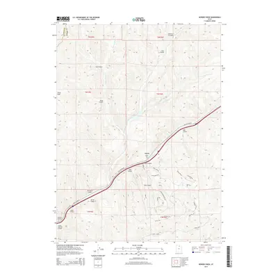
2014 Map of Heiners Creek
USGS Topo · Published 2014About this map
Emory sits at a critical intersection of high mountain drainages, where Echo Cr and the main branch of Heiners Cr converge. This 2014 survey documents the rugged landscape of Summit County, dominated by a complex network of canyons and hollows that define the local topography. To the north, Shed Hollow and Wolf Hollow feed into the northern forks, while to the south, names like Thirtyfive Canyon and Sawmill Canyon suggest a history of local resource extraction and land use. High points such as Windy Knoll overlook a modern road network that includes Echo Canyon Rd and Skyline Rd, illustrating how modern infrastructure navigates the steep grades of the Wasatch Range. For those tracing local families, the Emory Cem remains a primary landmark in the valley floor near the confluence.
Find a feature on this map
45 named features on this map. Tap any name to fly to it.
Don’t see what you’re looking for? This feature index may not catch every label — zoom into the map to look around manually.
Map Details
Editions of this 2014 Heiners Creek Map
This is the sole edition of this map. No revisions or reprints were ever made.
Other maps of this area

1885 · Salt Lake
USGS Topo · 1:250,000

1900 · Coalville
USGS Topo · 1:125,000

1903 · Coalville
USGS Topo · 1:125,000

1954 · Salt Lake City
USGS Topo · 1:250,000

1954 · Ogden
USGS Topo · 1:250,000

1958 · Ogden
USGS Topo · 1:250,000

1958 · Salt Lake City
USGS Topo · 1:250,000

1960 · Ogden
USGS Topo · 1:250,000

1960 · Salt Lake City
USGS Topo · 1:250,000

1964 · Lost Creek Dam
USGS Topo · 1:24,000