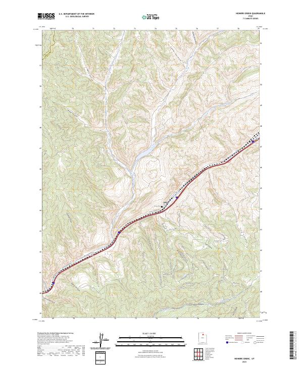
2023 Map of Heiners Creek
USGS Topo · Published 2023About this map
Echo Canyon dominates this landscape, serving as a historic conduit through the high country of Summit and Morgan counties. The settlement of Emory, accompanied by the Emory Cem, sits as a primary point of reference along the E Echo Canyon Rd and the interstate corridor. This passage has long been vital for travel and transport, carved out by Echo Creek as it winds toward the southwest.
Find a feature on this map
48 named features on this map. Tap any name to fly to it.
Don’t see what you’re looking for? This feature index may not catch every label — zoom into the map to look around manually.
Map Details
Editions of this 2023 Heiners Creek Map
This is the sole edition of this map. No revisions or reprints were ever made.
Other maps of this area

1885 · Salt Lake
USGS Topo · 1:250,000

1900 · Coalville
USGS Topo · 1:125,000

1903 · Coalville
USGS Topo · 1:125,000

1954 · Salt Lake City
USGS Topo · 1:250,000

1954 · Ogden
USGS Topo · 1:250,000

1958 · Ogden
USGS Topo · 1:250,000

1958 · Salt Lake City
USGS Topo · 1:250,000

1960 · Ogden
USGS Topo · 1:250,000

1960 · Salt Lake City
USGS Topo · 1:250,000

1964 · Lost Creek Dam
USGS Topo · 1:24,000