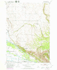
1951 Map of Heise
USGS Topo · Published 1979About this map
Snake River hydrology dominates the landscape south of the Madison and Jefferson county line, where a sophisticated network of irrigation infrastructure supported mid-century agriculture. Significant canals including the Sunnydell Canal, Poplar Canal, and Enterprise Canal divert from the main channel near the Diversion Dam. The topography transitions from the alluvial floor of Butler Island to the higher elevations of Kelly Mtn and the canyonlands to the east. Geothermal features are a distinct local characteristic, evidenced by Elkhorn Warm Spring, Hawley Warm Spring, and the Hot Springs near the settlement of Heise. Transportation corridors like the Union Pacific railroad and the curiously named Squires Duway track the western edge of the highlands, connecting small rural outposts like Jenson and Byrne.
Find a feature on this map
30 named features on this map. Tap any name to fly to it.
Don’t see what you’re looking for? This feature index may not catch every label — zoom into the map to look around manually.
Map Details
Editions of this 1951 Heise Map
3 editions found
Other maps of this area

1949 · Rexburg
USGS Topo · 1:24,000

1950 · Ririe
USGS Topo · 1:24,000

1950 · Rexburg
USGS Topo · 1:24,000

1950 · Rigby
USGS Topo · 1:62,500

1950 · Rigby SE
USGS Topo · 1:24,000

1951 · Rigby SE
USGS Topo · 1:24,000

1951 · Moody
USGS Topo · 1:24,000

1951 · Poplar
USGS Topo · 1:24,000

1951 · Hawley Gulch
USGS Topo · 1:24,000

1951 · Heise
USGS Topo · 1:24,000